
Solarigraph
Every sun path, over your view.
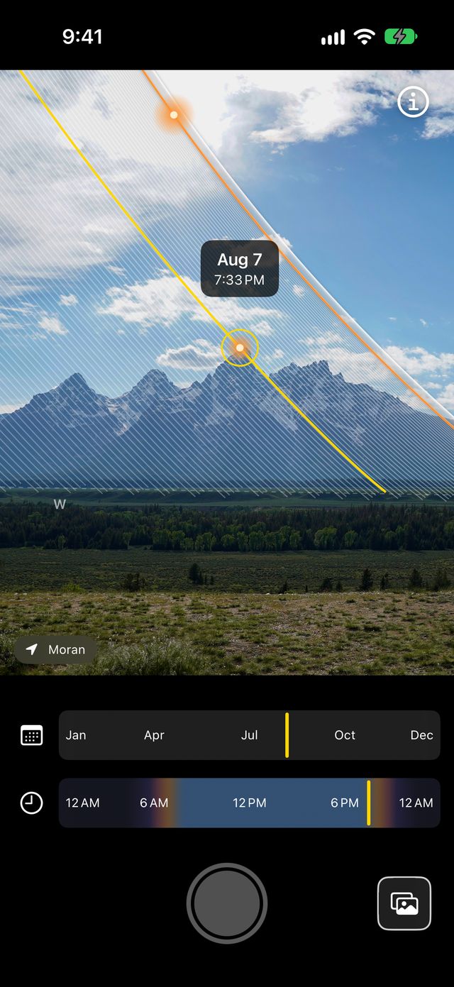
Point your iPhone at a window, a garden, a ridge line or a street, and see every path the sun will take from where you stand this year — where it rises, how high it climbs and where it sets — drawn over the live view from your camera.

The name
A solarigraph takes six months to make. This one is instant.
A solarigraph is a real photograph: a pinhole camera left open from one solstice to the next, recording the sun’s whole year on a single sheet of paper, one bright streak for every day.
Solarigraph works that picture out instead of waiting for it, from your location and the direction your phone is pointing, and draws it over what the camera sees right now.
How it works
Point, pick a day, keep the view.
Point it at the sky
The paths follow the phone as you move it, lined up with the real sky. Pinch to zoom from 0.5× to 5×.
Pick a day and time
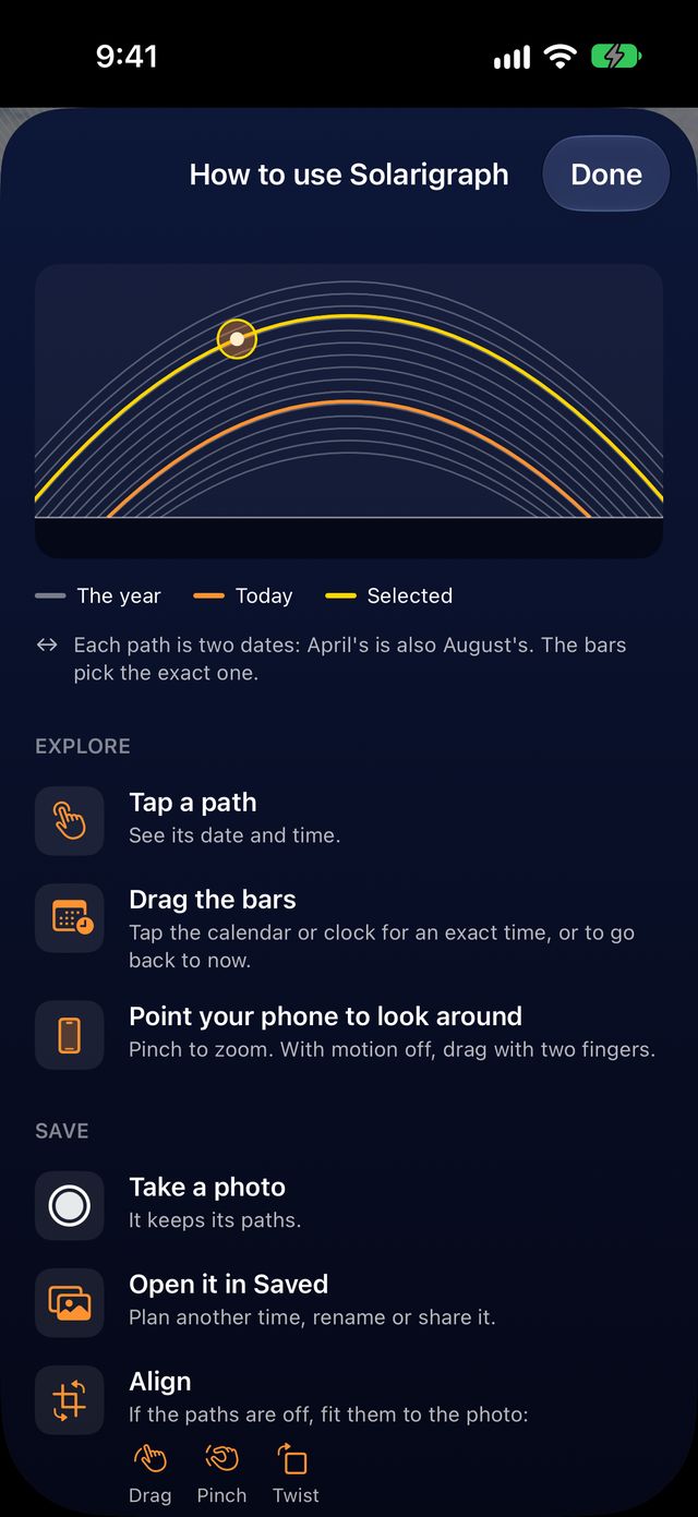
Tap or drag along a path to see when the sun will be there, or drag the date and time bars. Now brings you back to the present.
Save the view
The shutter keeps the photo with where it was taken and which way the phone was pointing, so you can plan from it later.
The whole year at once
One band, from the longest day to the shortest.
The pale band across the sky is every position the sun reaches from where you stand over a year. Today’s path is drawn in orange, and the moment you have picked in yellow.
When the sun is up but out of shot, an arrow at the edge of the screen points to it. Each path is two dates, one either side of the solstice: April’s is also August’s, and the bars pick the exact one.
Plan from home
Save a view, plan the light later.
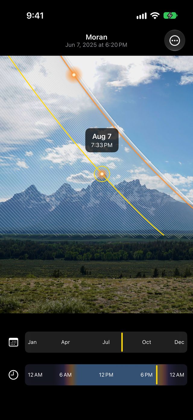
Reopen a saved photo from anywhere and the paths are redrawn for that spot, so you can plan a sunrise, a golden hour or a winter afternoon from your sofa.
Name a view, fine-tune its alignment with a drag, pinch or twist, and share it with the sun’s path drawn on or without it.
Saved
Every place you’ve stood, ready to ask again.
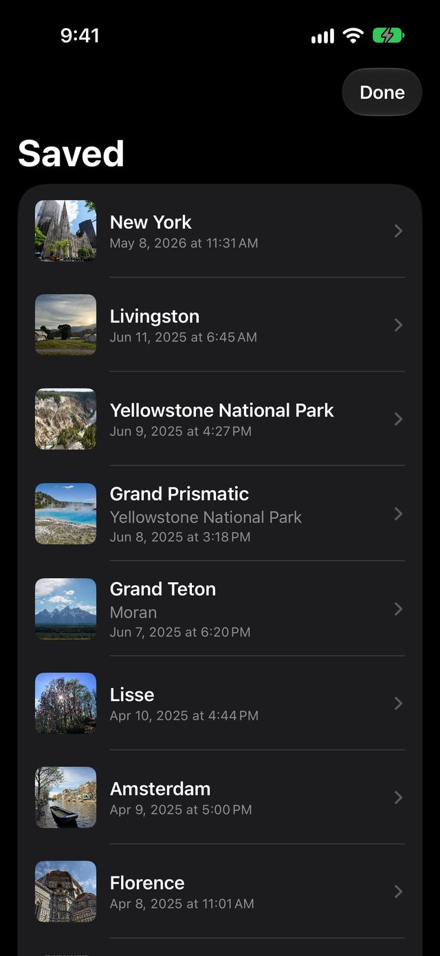
Saved views are listed by place name and the moment they were taken. Open one to try another date, another time of day or another season from exactly the same spot.
Useful for photographers timing the sun behind a landmark, gardeners finding which beds get winter sun, and anyone choosing a home, a desk or a café table for its light.
Privacy
The sky is worked out on your iPhone.
The sun’s positions are calculated on the phone. Photos and saved views stay on it. There is no account, no advertising and no analytics.
The only thing sent anywhere is the location being charted, to Apple’s own service, to show a place name. Read the privacy policy.
Details
- Price
- Free. No in-app purchases, no subscription, no ads.
- Requires
- iPhone · iOS 17 or later
- Permissions
- Camera, location while in use, and motion — each one used on screen as soon as it is granted
- Account
- None. There is nothing to sign in to.
- Data collected
- None
- Size
- About 3 MB
Questions worth asking first
The paths don’t line up with the real sun.
The alignment comes from the phone’s compass, which metal, magnets, cars and some cases can pull off by several degrees. Move away from them and wave the phone in a figure eight to recalibrate. For a saved photo, choose Align and drag, pinch or twist the paths into place.
Can I use it without the camera?
Yes. Turn the camera and motion off with the buttons on screen and drag with two fingers to look around.
Why does it need my location?
The sun takes a different path from every place on earth, so there is nothing to draw without it. It is used on the phone, and sent only to Apple to look up a place name.
Does it work offline?
Yes. The sky is calculated on the phone. Without a connection the app just shows no place name rather than a wrong one.
Know where the light will be.